
In the province of Lugo, between the coast of A Mariña and A Terra Chá, there are some ancient mountains, which sometimes disappear in the fog, where the wind blows fiercely and the xistra, that scourge of humid and icy air. The xistra takes over the mountain range and gives it its name: Serra do Xistral. In the highest parts, the soil also carries this humidity, forming large blanket peat bogs. Wet lands with a rich vegetation, based on heather and bryophytes. They are an ideal breeding ground for the cultivation of rivers. So the Landro, the Masma and the Ouro flow towards the Cantabrian Sea and the Eume towards the west, looking for the Atlantic Ocean. The search takes it through the province of Lugo (municipalities of Abadín, Muras, Vilalba and Xermade) and A Coruña (As Pontes, Capela, Monfero, Pontedeume and Cabanas) along 80 km.
The first waters of the Eume flow through A Balsa, in Muras, and Montouto, in Abadín. They are mountain villages of great natural wealth, with peat bogs, alluvial forests, birds of prey, wolves… Here wild Galician and Spanish-Breton horses and cows graze freely, so be careful on foggy days, abundant here, lest they suddenly appear and we get a scare.
The Eume takes us through protected areas from its source, as the Serra do Xistral is ZEC and ZEPVN, and is part of the nature reserve As Terras do Miño, to which also belong the municipalities of A Terra Chá through which the river passes (Abadín, Muras, Vilalba and Xermade).
The fact is that, just after leaving the mountains, entering the province of A Coruña, begins the Natural Park of Fragas do Eume, which occupies part of the municipalities of A Capela, As Pontes, Cabanas, Monfero and Pontedeume. Another protected area where the landscape changes but is equally beautiful.
The first stop is As Pontes, a very large municipality, which extends through a depression surrounded by heights. Here flows the Eume in its middle course, where it is fed by several tributaries. And, as the toponym announces, there is no shortage of bridges; the most significant, the Roman bridge, the Os Ferros bridge, from the 15th century, and the Isabel II bridge, from 1860. Between the latter two there is a wooden walkway along the river bank.
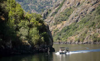
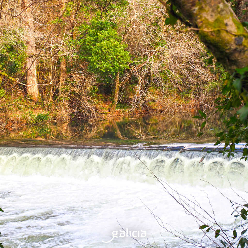
In As Pontes, the waters of the Eume are dammed in the reservoir of A Ribeira, where canoes are common. If the dam seems small to us, we only have to approach the Lago das Pontes, a gigantic artificial lake that takes advantage of the space left by the open-pit lignite mine, exhausted years ago, raw material for the As Pontes Thermal Power Plant, which ended its activity in 2023.
There are several hiking trails for a walk along the river, such as the path of A Ribeira, or As Fragas da Ribeira and Lostregal. Other trails take us through the history of the place, marked by the thermal power plant, such as the Calvo Sotelo trail or the Memory trail, around the lake.
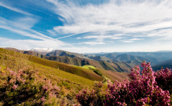
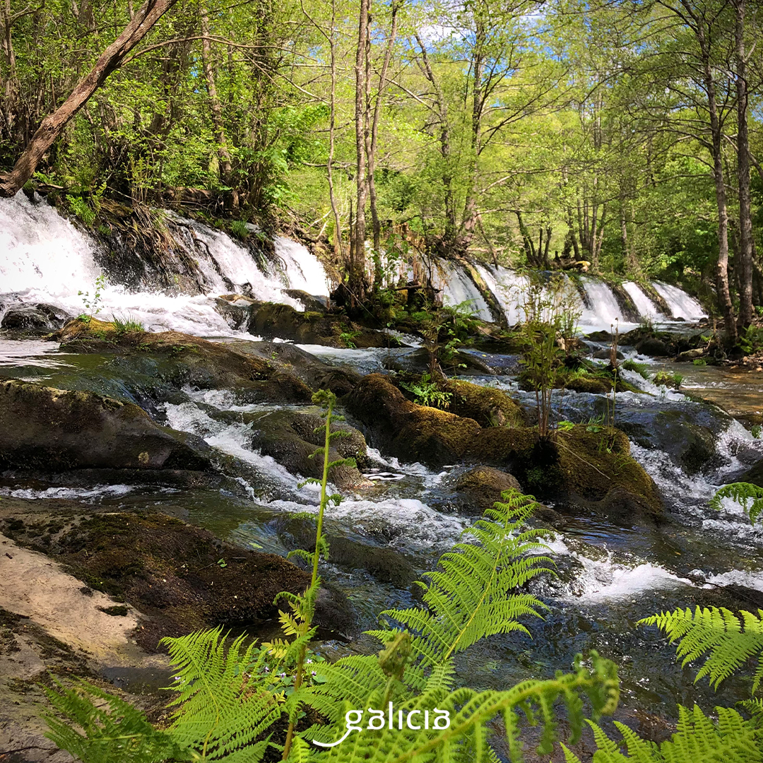
After this stretch, the river becomes more embedded, until it ends up crossing a deep canyon, already in its final course. It is the lushest part of the park, with ecosystems of very high biodiversity, rich in bushes, heather and broom in the upper areas and in oak, birch, alder, ash… One of the few examples of Atlantic forest in Europe. There are also up to 28 different species of ferns and many mosses and lichens. As for the fauna: salamanders, toads and frogs, the typical Galician salamander, roe deer, deer, otters…
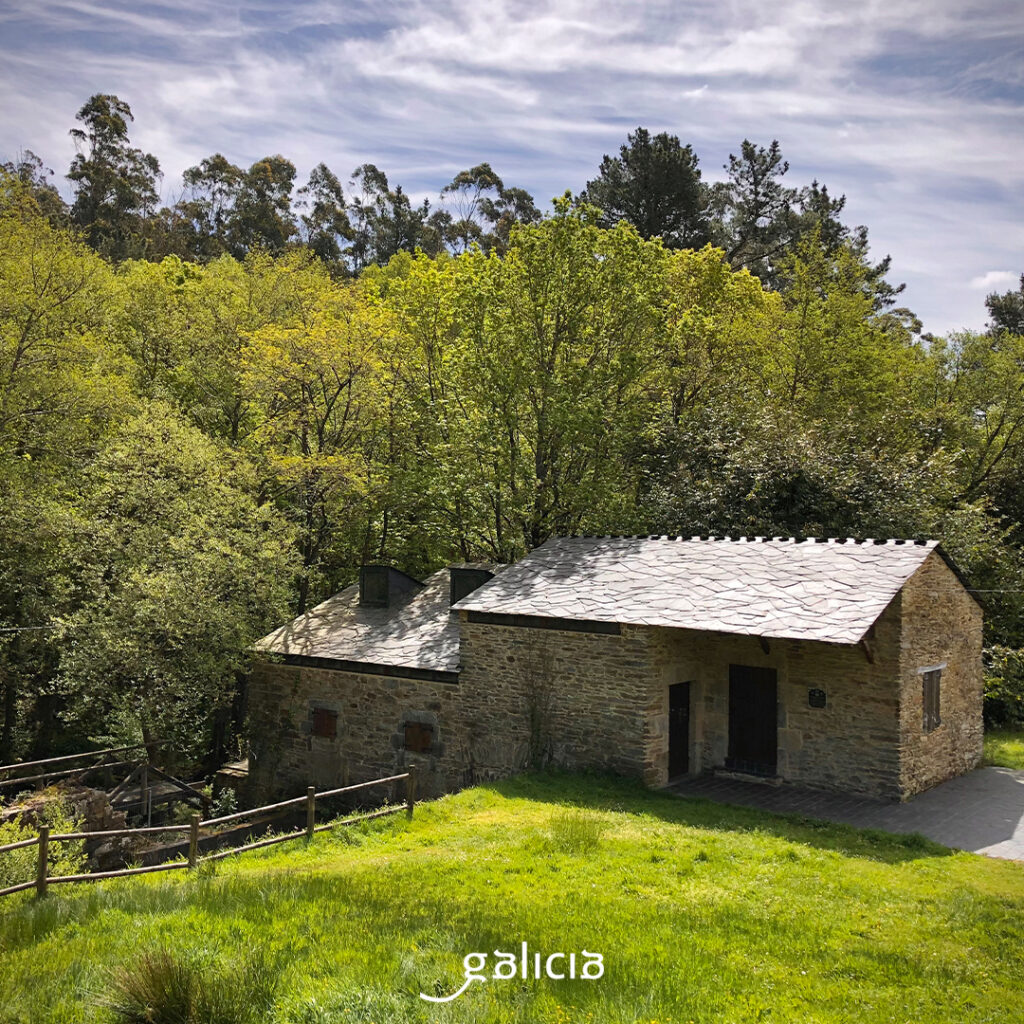
To discover the most surprising corners of the forges, the best thing to do is to take the hiking trails, marked paths in the middle of the forest with many viewpoints, bridges, areas where you can fish or practice water activities, interpretation centers… And let’s not forget two great works of architecture, perfectly integrated among the trees: the monasteries of Caaveiro and Monfero.
Already at the mouth of the river, Pontedeume is located at the foot of Mount Breamo, on the southern bank of the estuary of Ares, in front of the estuary. It is a city with a strong medieval footprint, marked by the Andrade’s domain. It has an important historical ensemble, with the Andrade Tower, the arcades of Real street, the convent of San Agustín, the hermitage of Virtudes, the church of San Martiño, Angustias square, Real square, Pan square…
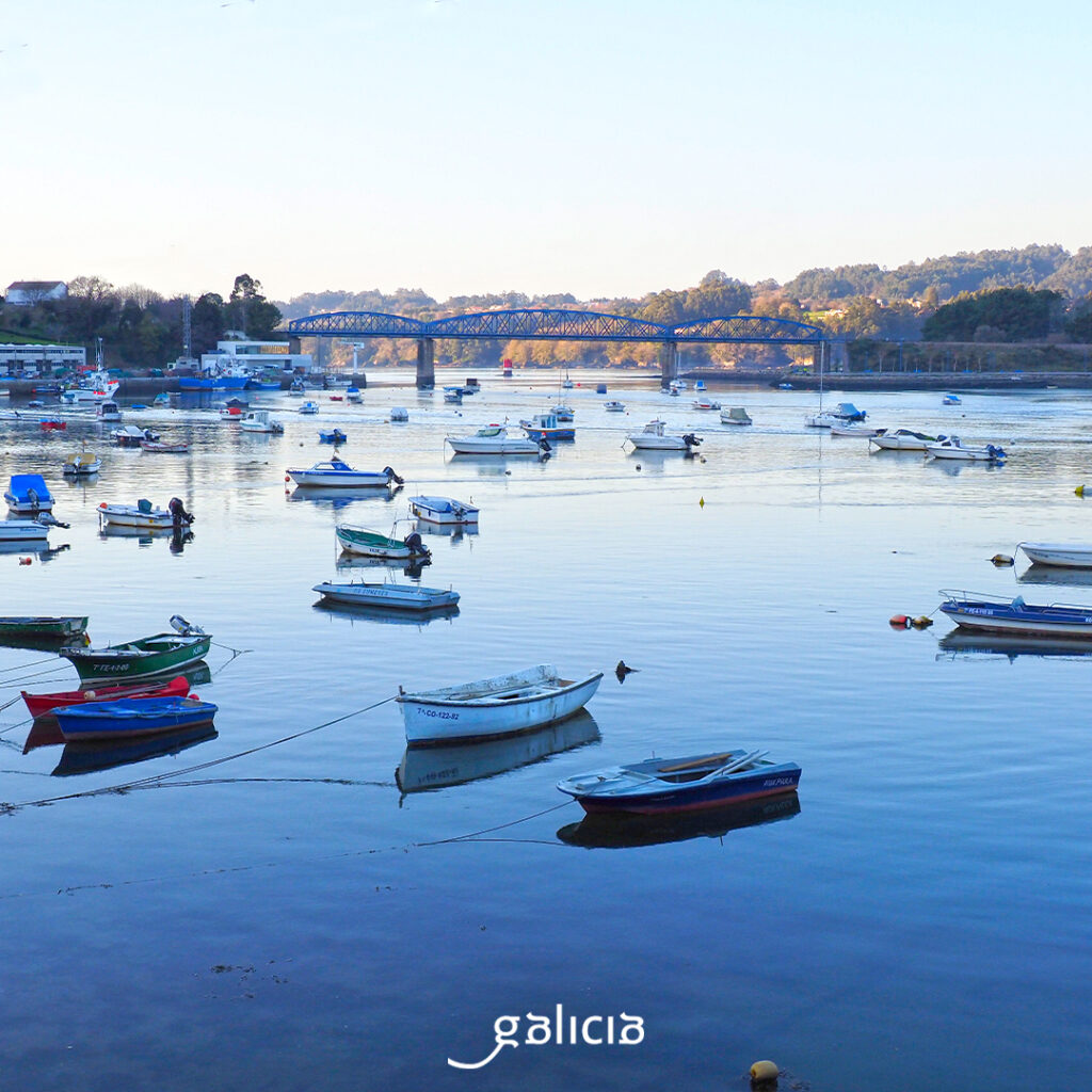
From the port, we can continue along the banks of the Eume and even cross the medieval bridge and continue along the promenade of Cabanas. We are sure to come across some pilgrims, because Pontedeume is an important stop on the English Way.
We are already at the end of the route: the Ares stuary. It is next to Betanzos, which hosts the Mandeo. The two estuaries, separated at the beginning by the Punta da Carboeira, meet in the ocean.
The Ares estuary, with the Betanzos, Ferrol and A Coruña estuaries, form what Otero Pedrayo called the Artabrian Gulf, like the Portus Magnus Artabrorum of which the Romans spoke, that fringe of our coastline that gives cozy estuaries, suitable for anchoring, sheltered by capes with large cliffs. Inland, the river valleys that lead to them, as well as rich wetlands and lagoons, such as Valdoviño. To the south, a biosphere reserve, As Mariñas coruñesas and Terras do Mandeo, and the entire coast of this gulf, a special conservation area.
The main cities are A Coruña, Ferrol, Sada, Betanzos, Pontedeume, Ares, Mugardos, Fene, Neda and Narón. One of the most emblematic destinations of the gulf is Santo André de Teixido, where “vai de morto o que non foi de vivo” (where he who doesn’t go alive there, goes dead).
Along the coast we find lighthouses in impressive cliffs, such as Ortegal, where A Serra da Capelada ends, Punta Frouxeira or Cape Prior. At a lower altitude and more sheltered, that of Mera and, already in A Coruña, the Tower of Hercules, the World Heritage Lighthouse.
To top it off, after so much fresh water, an Artabrian bath. We have plenty of beaches to choose from: Razo, Barrañán, Doniños, Pantín, Mera, Perbes, Miño, Santa Cristina…