

The Tambre is the great river of the province of A Coruña. It flows for 130 km from A Lagoa de Sobrado to the estuary of Muros e Noia, where it embraces the Atlantic. It is a river of generous flow and fishing, with preserves such as those of A Ponte Maceira, Chaián and Sigüeiro, where trout are caught, or Noia, for sea bass. Of course, in the past there were even salmon and lamprey. We can also practice nautical sports and bathe in some river beaches, such as O Refuxio or Chaián, for example.
The Tambre river, which in the oldest maps appears as Tamaris, and later Tamara, has a lot of history. It gives its name to the Trastámara lineage (from trans Tamaris, that is, beyond the Tambre), and even to Los Tamara, the famous music group from Noia. The Tambre also witnessed the medieval fights between Xelmírez and the Count of Traba, the battle of A Ponte Maceira, in 1471, and the battle of Sigüeiro, in 1846 (next to the bridge and the disappeared tannery).
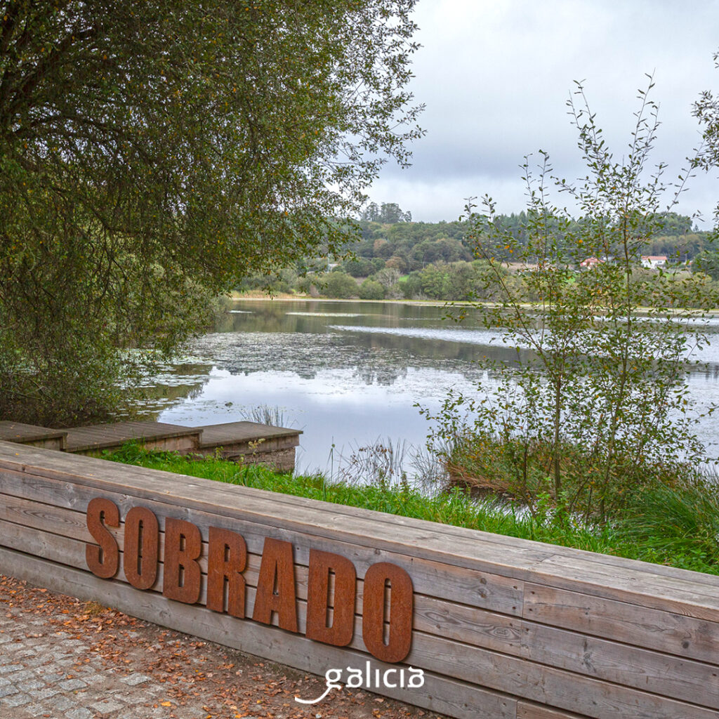
Anyway, let’s get into the course of the river. The sources of the Tambre meet at A Lagoa de Sobrado, in Terra de Melide, 510 m above sea level, in the Serra de Bocelo. It is a good area for rivers, as this is also the source of the Mandeo. And what does Sobrado remind us of…? Of Os Monxes, of course. One of the treasures of this municipality is the Cistercian monastery of Santa María. Precisely, the lagoon, 1 km from it, was built by the monks in the 16th century. There they dammed the waters of several streams that form the sources of the Tambre River. They made it for the monastery’s service (water for the kitchens, for the lands, for fishing…). Today, after so much time, the lagoon is already natural, with riverside vegetation. Water lilies and water spikes abound in the water. The monastery is a World Heritage Site, as are the Pilgrims’ Roads to Santiago de Compostela that pass through here, which are the northern and the Primitive. In fact, the building has a hostel as well as a guest house.
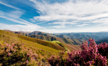
The Tambre continues through Terras de Ordes, where it passes through the municipalities of Mesía, Frades, Oroso, Ordes, Trazo and Tordoia. This middle and upper basin is a SAC and SCI area of the Tambre river, with important riverside vegetation. We can check this richness by doing the Ruta Fraga dos Muíños (trail PR-G 117), for example, which passes through Mesía and Ordes. Another nice walk is the one that takes us along the Vía Verde Compostela-Tambre-Lengüelle. It is the longest greenway in Galicia, with 28.36 km, and takes us from Oroso to Cerceda.
The English Way goes through Oroso. In this municipality, one of the most important places through which both the Way and the Tambre pass is Sigüeiro. In this town there are many areas equipped to have a good time on the banks of the Tambre. For example, the Illa do Refuxio (Refuge Island), where there is a pleasant recreation area with grills, tables, etc., with access via two walkways to a small elongated island next to a dam, which even has a river beach. In this area is the Sigüeiro fishing preserve, known for its trout. In fact, on the second Sunday of May the trout festival is held, with a fishing contest included.
On the right bank of the Tambre, also in Sigüeiro, we find the recreational area of A Penateixa, an open space with alders and oaks and a picnic area.
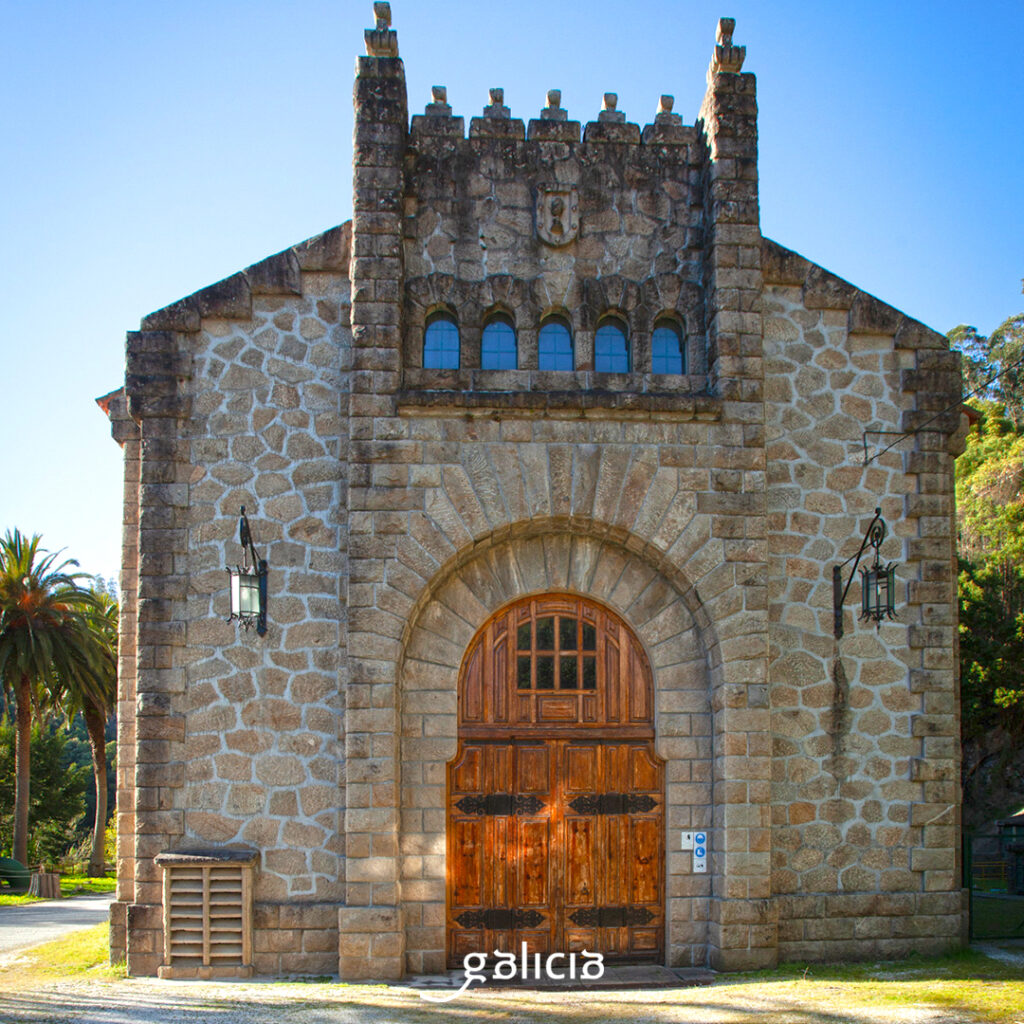
Further on, in Negreira, in the parish of Portor, the Tambre is crossed by A Ponte Maceira, which gives its name to the village that, by the way, appears in the catalog of “The most beautiful villages of Spain”. The bridge, with five arches and two smaller ones, is medieval, and is built on the foundations of an earlier Roman bridge. The place is a monumental ensemble, with a primitive village, an old mill, a dam, the chapel of San Brais and the Baladrón manor house. In the 15th century it witnessed the fights between Archbishop Fonseca and the lords of Moscoso, in the so-called battle of Altamira or A Ponte Maceira. Through this picturesque village passes the Camino Maritimo, which connects Compostela and Fisterra, so we always find pilgrims.

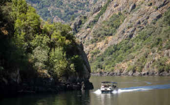
Moving towards the coast we pass by the Tambre Hydroelectric Power Station, a 1924 building designed by Antonio Palacios. Here was made the first industrial electrical exploitation of Galicia, destined to large consumptions. In this area there is an interpretation center of the Tambre reservoir. Today, near the plant there is a small hotel, a suspension bridge, mills, and trails that take us from one side to the other.
On the left bank of the river, from the border of Brión to the hydroelectric plant, is the Devesa de Nimo, a coastal Atlantic forest of holly, holly, willows, ferns… and diverse fauna (otters, herons, foxes, kingfishers…). Traditionally, this was a lamprey area, so we find pesqueiras in the river.
Already towards the mouth, joining the municipalities of Noia and Outes, we find the medieval bridge Ponte Nafonso. It is a long bridge, with 20 arches, although originally there were 27, and it seems to have been ordered to be built by Alfonso IX.

The Esteiro do Tambre natural area (SAC) covers the last stretch of the river and the eastern half of the estuary, between the municipalities of Brión, Negreira, Outes, Noia and Porto do Son. This entire area is protected by the 2000 nature network. Here there are more than 1,500 ha of intertidal muddy-sandy spaces where many aquatic birds winter and a very rich vegetation, mainly based on reeds. All around, forests of oaks, ash and alder trees.
The entrance of the Tambre in the Atlantic gives rise to a very fertile habitat for clams and cockles, especially. We are in an estuary of incredible beaches, with nearby mountains, hillforts and cities steeped in history such as Muros and Noia. A farewell in style for this great river.