

The sources of the Ulla are in Olveda, in the municipality of Antas de Ulla. There, in A Chousa da Poteira, from the first drops under the root of a tree, the Ulla begins its journey, among birch and oak trees. We are in the province of Lugo and, from here, the river makes its way along 132 km, marking almost the entire boundary between the provinces of A Coruña and Pontevedra, until it reaches the Arousa estuary, where it joins the Atlantic, in the largest estuary in Galicia.
In the same region of A Ulloa, about 12 km from its source, the river flows through Monterroso. A good place to enjoy it is the recreational area of A Peneda, where we find a bit of everything: steps to cross the river, wooden walkways, mills, archaeological remains …. There is also space for a good swim, in the river pool, and for fishing in the trout preserve. In the same recreation area there are more swimming pools, tennis courts and camping. There are also hiking trails, such as A Pena do Corvo.
Monterroso was an important enclave in history and prehistory, just look at the number of castros, mámoas, petroglyphs, pazos, such as A Torre, churches, such as Novelúa…
Several Roman roads used to pass through here, among them the XIX and, through the parish of Ligonde, the French Way, in the Portomarín-Palas de Rei stage.
While we are here, we can take the opportunity to visit Melide, in the province of A Coruña, which is very close. Melide is a key point of the Camino de Santiago, since the French and Primitive Ways pass through here. It is most likely that the city was born precisely because it is on the Camino. In addition, this fact has endowed it with great monumental wealth, as we can see in Santa María de Leboreiro, San Xoán de Furelos, the church of Sancti Spiritus… Melide has been the scene of several historical events, such as the struggles against the French troops in the War of Independence, expelled with the help of the Battalion of Monforte.
Before leaving Melide, we have to taste the wonderful melindres (traditional cookies), which even have their own festival in May, amendoados (almond cookies) and cheeses, among other delicacies.
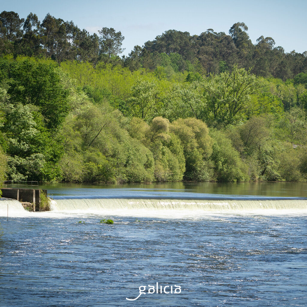
We are practically in the geographical center of Galicia. Here, the water of the Ulla is contained in the Portodemouros reservoir, between Arzúa and Vila de Cruces, where it receives the waters of the Deza. The margins also give to Santiso and Agolada. We are already talking about two provinces: A Coruña and Pontevedra. In the reservoir, the banks of Beigondo and Loño are connected by a curious ferry, which sounds a siren or horn. Inland, there are many forts, such as San Román, pazos, hórreos… and even a museum of beekeeping.
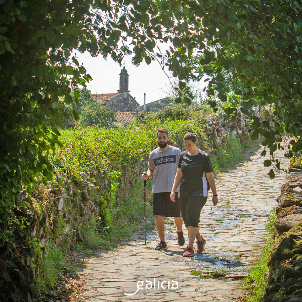
As it passes through the Concello de Touro, the river Ulla offers ideal places to enjoy nature, go for walks or simply relax by the water. Worth a visit are the waterfalls of its streams that flow directly into the Ulla, in an environment made up of riverside forests and native species. There are three approved hiking routes that run along the banks of the Ulla in this municipality: PR-G 93 Route of the banks of the Ulla, PR-G 121 Route of the three rivers and PR-G 233 Route of the Fervenza das Hortas to the river Lañas. Restored mills, waterfalls and petroglyphs accompany us along the route.

In Vedra, near Santiago, we find one of the most important salmon preserves in Galicia: Couto de Ximonde, in the parish of Couso, in A Estrada. In the refuge there is a river interpretation center and a breeding and reproduction ichthyological station. It also has a recreational area. If we happen to be there during the third weekend of May, we have a must: the Salmon Festival of A Estrada.
O Xirimbao, in Teo, is also famous for its salmon. It communicates with Couto de Ximonde through a footbridge that, at the same time, joins two municipalities and two provinces: A Estrada, in Pontevedra, and Teo, in A Coruña. This bridge is one of the longest suspension footbridges in Galicia, 80 m long and 1.80 m wide. O Xirimbao also has its own recreational area, with parking, tables, trails… On the first Sunday in August, the Festa do Escalo (Fishing Festival) is held, a fishing contest for children and adults that ends with a feast of the caught escalos (kind of fish, Squalius carolitertii).

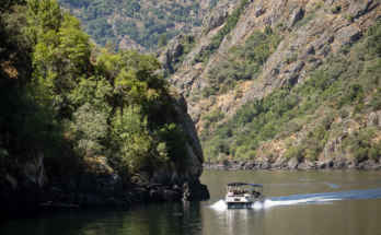
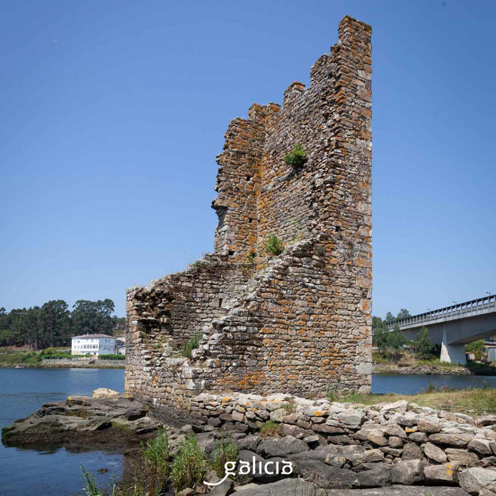
After passing the salmon preserve of Sinde, the rafting area, quite popular here, Herbón, Iria Flavia and Pontecesures, we approach the marshland area, a prelude to the mouth of the estuary. On the left bank of the estuary is Catoira. Here, as if emerging from the water, the remains of the Torres de Oeste, a fortress that defended the lands of the archdiocese of Santiago from Norman attacks during the Middle Ages, are still standing. On the first of August those times are remembered in the Romaría Viquinga de Catoira, a Festival of International Tourist Interest.
In the municipalities of Catoira, Valga, Pontecesures, Vilagarcía de Arousa, Padrón, Dodro and Rianxo, at the end of the course of the river, the marshy areas open up and the riverside vegetation abounds. The estuary, between Rianxo and Carril, as well as the river and banks of the Ulla and the final stretch of the Deza, its main tributary, make up the ZEC Ulla-Deza fluvial system, a very rich area where mussels, scallops, oysters, clams…
One of the routes of the Way of St. James runs through this area: the Route of the Sea of Arousa and Ulla River, also called Translatio Xacobea. It commemorates the arrival in Galicia of the body of the Apostle, accompanied by his disciples Athanasius and Theodore, from the port of Jaffa. It seems that they entered through the estuary and, following the course of the Ulla and Sar, arrived at Iria Flavia, where they moored the boat to the Pedrón and, after some troubles with the Raíña Lupa, buried the saint on Mount Liberum Donum (Libredón). The maritime route is joined by two terrestrial routes along the banks of the estuary: the northern Translatio route (Ribeira, A Pobra do Caramiñal, Boiro, Rianxo, Dodro) and the southern Translatio route (Sanxenxo, Meaño, O Grove, Cambados, Vilagarcía de Arousa, Catoira, Valga and Pontecesures). And we continue from Padrón to Santiago, through Rois, Teo and Ames.

Every summer, between the end of July and the beginning of August, a procession of decorated boats leaves from different ports of the estuary towards Pontecesures and Padrón. Whoever completes the route obtains the diploma of the Translatio Xacobea. In this route we can see up to 17 cruceiros, installed last century, which form a peculiar Way of the Cross.
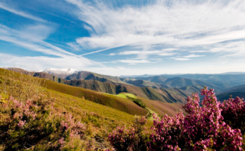
Returning to the sea, we have to appreciate the Ría de Arousa as it should. The Ulla and Umia rivers flow into it. This estuary is very large and very rich in seafood, in wines (DO Rías Baixas, with capital in Cambados), in castros, in pazos, such as Fefiñáns, , monasteries such as Armenteira, which is called “the cathedral of O Salnés”, and impressive beaches in Ribeira, A Pobra, Rianxo, O Grove…In fact, it is one of the most touristic areas of Galicia. The estuary is home to several islands: Arousa, A Toxa, Sálvora and Cortegada (the last two are part of the Parque Nacional das Illas Atlánticas).