

There was a time when to speak of the Sil was to speak of gold. It seems that even the name, which in Latin means ochre, refers to golden lands. The truth is that the waters of this river must be nourishing, because along its course there are natural parks and protected areas, incredible landscapes to enjoy and preserve.
The Sil is the second most important river in Galicia, after the Miño, into which it flows. It reaches 234 km in length, 119 of which correspond to Galicia. It begins its journey in La Cueta, which is in the Biosphere Reserve of Babia, in the province of León. Near this town, about 2 km away, are the sources that originate the Sil, at the foot of the Peña Orniz, at more than 1,000 m above sea level. After passing through the regions of Laciana and Bierzo, in the province of León, it enters Galicia through the region of Valdeorras, in the province of Ourense.
We arrive at another area of great ecological wealth: the Parque natural da Enciña de Lastra, in the municipality of Rubiá. The landscape is dominated by limestone peaks, which are not usually seen in our community, with very important heights, such as Pena Falcoeira, or Penedos de Oulengo. This peculiarity, added to the presence of many palas (caves), with a large population of bats, by the way, make this a destination of great geological interest. The flora of the area is not what we usually see here either, as it is of Mediterranean type, with cork oaks, oaks, holm oaks, olive trees, thyme trees, holm oaks? In addition, with the arrival of spring, we can find up to 25 different species of wild orchids.

Between these mountains, the Sil river flows through steep slopes. Several Roman roads pass through here, among them the Via Nova or XVIII, the one that went from Braga to Astorga. There is also a hiking route, the Route of O Val do Sil, which runs parallel to the river from the viewpoint of Covas to Vilardesilva, among large holm oaks.
Following the course of the Sil we arrive at O Barco de Valdeorras. The river enters the municipality in a very tight fit to open up into a large valley, where it receives the waters of several tributaries and streams. The Via Nova also continues through here, as well as The Winter Way, which will follow us to Quiroga.
One of the most typical places to walk around O Barco is the Malecón: more than 1 km of signposted route along the riverbank, which includes a river beach, recreation area, green areas and terraces for a drink.
In the buildings of O Barco you can appreciate the characteristic reddish stone of the area. Other things to see there are: the monastery of San Miguel de Xagoaza, today a winery; the old town; the big house of Viloria; the monumental complex of O Castro and the curious covas, which are traditional cellars dug into the ground.
There is also a great fondness for water sports. In fact, in the month of May the White Water Championship is held and, on the day of the patron saint’s day, September 14, the Descent of the Sil.
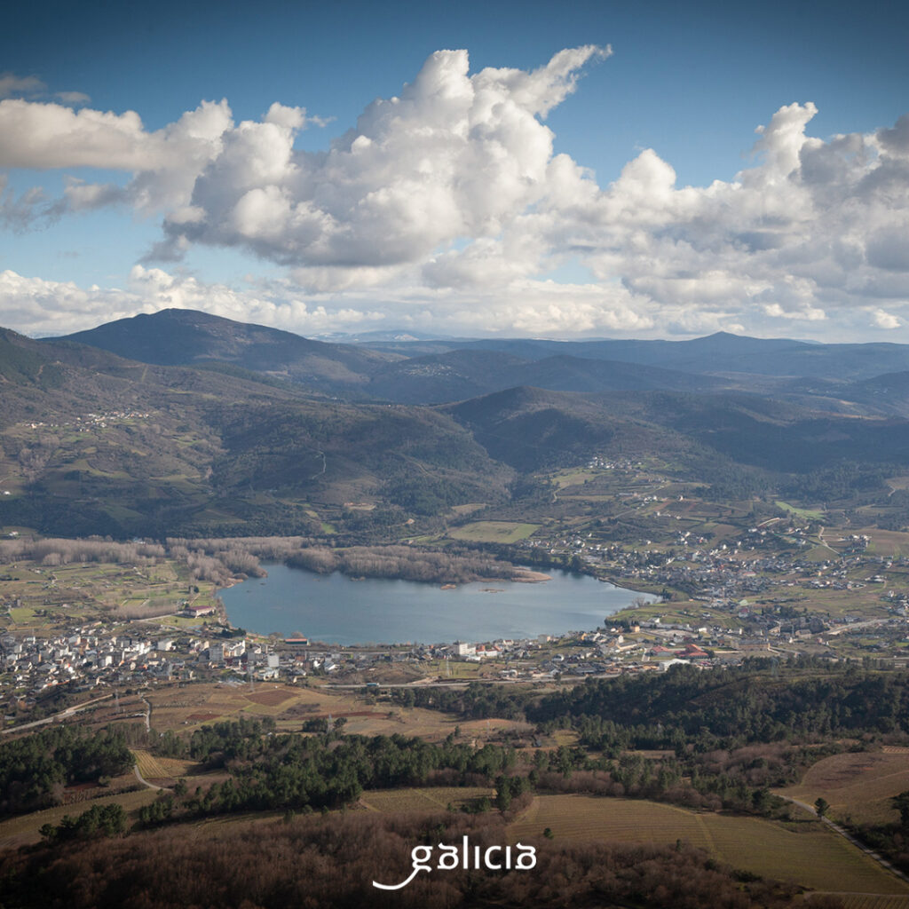
Downstream, 14 km away, we find the San Martiño reservoir, in a fertile flat area with a Mediterranean climate. On the left bank is Petín and, on the right, A Rúa. The reservoir extends between the two municipalities like a lagoon, with up to 15 islets, constituting an authentic refuge for aquatic birds. Leaving San Martiño, at 400 m, the Sil is crossed between A Rúa and Petín by the A Cigarrosa Bridge, of Roman origin, where the Via Nova used to go. And, before continuing northwest, passing through the province of Lugo, you will have to drink a Valdeorras wine with a pulpo á feira (octopus popular dish), for example, which is very local.
In the region of Quiroga, already in Lugo, shortly before the confluence with the Bibei, the tunnel of Montefurado awaits us, in the Pena do Corvo, testimony of the use of the resources of the Sil by the Romans. The mountain was drilled under the mandate of Trajan in the 2nd century, to redirect the course of the river, avoiding a closed meandering and leaving the sediment area open to the air, thus making it easier to extract gold. A system similar to the ruina montium, in which the mountains were made to burst by drilling channels inside them and filling them with water.

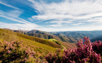
The UNESCO World Geopark Montañas do Courel includes this area, which has a very rich geological heritage, with examples of geological structures, fossils, traces of mining… Precisely, in Quiroga we can visit the Geological Museum and the Ethnographic Museum. Other points of interest are: the village of A Seara, in the heart of A Serra do Courel, the Vieiros reservoir, the Lagoa de Lucenza, the Bendilló oil mill, the Castle of As Novaes, the church of A Ermida or the historical complex of the Hospital.
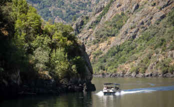
There are also wines in these parts, but here we are not talking about the DO Valdeorras, but about the DO Ribeira Sacra. In this final stretch of the Sil, the river flows through a deep canyon, between granitic slopes and vineyards, with a microclimate that makes the wines grow very well. To enjoy the views from all angles, it is best to take one of the river routes that operate in the Ribeira Sacra, some with stops to visit wineries and monuments. In the Sil canyon there are wonders such as the monastery of Santa Cristina de Ribas de Sil, or Santo Estevo, the castle of Castro Caldelas …. We also have to see the perspective from the top, and climb to viewpoints such as Cabezoás, Os Balcóns de Madrid, As Xariñas…

In the Ribeira Sacra, meander after meander, the Sil meanders between the provinces of Lugo and Ourense, and reaches Os Peares, parish of A Peroxa, in the province of Ourense. Os Peares is a real meeting place, where four municipalities and two provinces come together (A Peroxa and Nogueira de Ramuín in Ourense and Carballedo and Pantón in Lugo), all overlooking the river. Here the waters of the Sil also meet the Miño, which also receives another tributary, the Búbal. Shortly before the confluence, the water level rises in the Os Peares reservoir.

Thus, in Os Peares we say goodbye to the Sil, which dissolves into the Miño, giving it a very generous flow, so that it can continue on its way to Ourense. Bon voyage!