

Among all the Galician rivers, there is one that is not only a river, it is a symbol. To name it is to name Galicia as a whole, although it does not reach everywhere. It is the Miño, the longest and most abundant river in the community. It passes through the provinces of Lugo, Ourense and Pontevedra along 310 km. Following the route it describes, we can see how the flow of the water carves its way, extended and slow in the flatter and higher areas, then it fits between mountains, making curves in deep canyons, relaxing again, in the company of small and large islands, until the valley disappears and the Miño gives itself to the Atlantic Ocean.
So where does it all begin? Well, in the province of Lugo, on the western slope of the Serra de Meira, in O Pedregal de Irimia, in the municipality of Meira. There springs a tiny Miño, in the moraine of an old glacier, a place full of stones, as the name says, at almost 700 m of altitude. It grows little by little with the contributions of other streams and springs, such as Fonmiñá, in A Pastoriza, just 6 km away, long considered the cradle of the river, in a lagoon where the so-called “eyes of the Miño” bubble. In O Porto da Pena, in Santa María de Meira, the streams are also joining in the infancy of the river. Before leaving Meira we have to stop in the center of this town, full of history, where the monastery and the church of Santa Maria, with its splendid rose window, stand out.
We continue accompanying a Miño already well visible in its upper course, which runs through the Terra Chá. We enter the Terras do Miño Biosphere Reserve, one of the largest in the peninsula, determined by the upper basin of the Miño and its tributaries and the Serra do Xistral. Here, the Miño River joins forces with the waters of the rivers Parga, Ladra and Támoga, ZEC area, where the humid complex of A Terra Chá is formed, rich in wetlands, cultivation areas, lagoons, such as Cospeito, Caque and Riocaldo, and small islands, such as those of Rábade and Outeiro de Rei. Especially the lagoons are privileged places for bird watching. The Guitiriz Water Route also runs through this area. The natural wealth of the reserve is accompanied by the archaeological, with megalithic burial mounds and castros (Celtic forts) such as Viladonga, in Castro de Rei, which even has a monographic museum. Moreover, in Outeiro de Rei, there are also the Avifauna and Marcelle Natureza zoological parks, and the house-museum of the poet Manuel María.
The reserve also reaches the provincial capital. At 73 km from its source, the river is already more embedded in the terrain. Here, the primitive Way passes over the Miño, over the Ponte Vella, of Roman origin. A few meters from this bridge, the Miño River Walk begins, where the Lugo Spa is located, which preserves the remains of Roman baths. Further on, on the Paseo del río Rato, we find the Centro de Interpretación da Reserva da Biosfera Terras do Miño, which always offers interesting activities. And, since we are in Lugo, we have to visit the historic center, with the cathedral of Santa Maria at the head, take a walk along the parapet of the Wall, and have a drink in the wine street, at least.

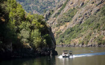
In the middle course, the river valley becomes larger, until it reaches the confluence with the Sil, which gives it a generous flow because, as it is said, “O Miño leva a fama e o Sil dálle a auga” (The Miño takes the fame and the Sil gives water). Here, the river advances sinuously between high banks that are dedicated to the cultivation of the vine. We are in the heart of the Ribeira Sacra, which we can get to know from the river itself, as it has several piers and river routes. The landscape leaves us with our mouths open, either from below or from one of the viewpoints at the top of the mountains. In addition, scattered along the riverbank, we find several works of Romanesque art, such as the churches of Santo Estevo de Ribas de Miño, San Facundo de Ribas de Miño and Santa María de Pesqueiras. Other places to visit are the castle of A Peroxa and the Castromaior castro, for example. The French Way crosses the Miño in Portomarín and the Winter Way, at Belesar, between the municipalities of Chantada and O Saviñao.

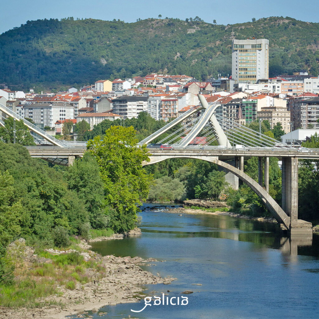
Arriving at A Peroxa, we enter the province of Ourense. In about 15 km we are in the capital, where the Miño is crossed by the Vía de a Plata, which goes over the Ponte Vella, of Roman origin. In Ourense, the river is accompanied by numerous springs, such as those of As Burgas, in the city center, and those found along the Paseo Termal del Miño, with up to seven thermal areas concentrated in just 4 km. In the center of the city we have to visit the historical center, with the cathedral of San Martiño and its Pórtico do Paraíso.
We continue between thermal waters and vineyards in the region of O Ribeiro. The capital, Ribadavia, a medieval town steeped in history, also houses the Galician Wine Museum. In this area, the river is fed by the waters of the Avia and, further on, by those of the Arnoia and the Deva.
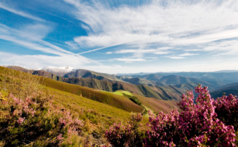
Already in the final stretch, the Miño flows through the province of Pontevedra in search of the ocean, marking the border with Portugal in its last 77.8 km. In fact, from the confluence with the Barxas River to the mouth, we speak of TIRM (International Section of the Miño River). The Raia húmida passes through the regions of A Paradanta, O Condado and Baixo Miño. They are also good lands for wine, in this case, DO Rías Baixas. The main towns are Salvaterra de Miño, between the confluence of the Tea and Miño rivers, with an important heritage, such as the fortress and the Castle of Doña Urraca; Tui, a medieval town, with an imposing cathedral with a Gothic façade; and A Guarda, with its great hillfort. On the other hand, between Crecente and Salvaterra de Miño, we find up to 400 fishing boats to catch lamprey, the delicacy of the area, in season between January and April. It is also an ideal stretch for the practice of nautical sports.

At the end of the river bed, at the gates of the sea, there is a succession of wetlands, reed beds, morraceiras (wet meadows), islands and ariños (sandbanks). Fortunately, this landscape, frequented by birds from all over the world, is protected as ZEC Baixo Miño and ZEPA Estuario del Miño. By the way, along this stretch is also present the Camino de Santiago, specifically the Portuguese, which crosses from Valença to Tui, and the Portuguese of the coast, between Caminha and A Guarda.
Precisely in A Guarda, from the top of the mountain of Santa Trega, we have a breathtaking view of the mouth of the river. The best place to say goodbye to the Miño.