The Lérez river is a very Pontevedra river: it does not pass through any other province and, besides, it flows into the Pontevedra estuary. It begins its course in the mountain of San Bieito, in the Serra do Candán, where the Umia and the Verdugo also originate. From here, in A Noveliza, parish of Aciveiro, municipality of Forcarei, to be more precise, the Lérez flows southwest, for about 60 km, until it flows into the estuary.
During its course, the vegetation is rich and diverse, with gallery forests, autochthonous forest and, in the highest areas, heather and broom. In its last stretch it is a SCI and SAC area, as it passes through the municipalities of Cerdedo-Cotobade, Campo Lameiro and Pontevedra.
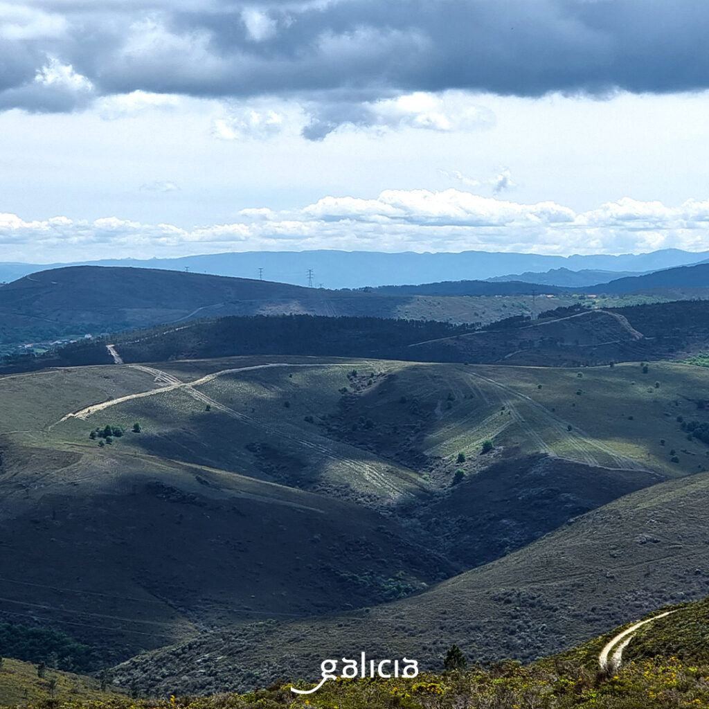
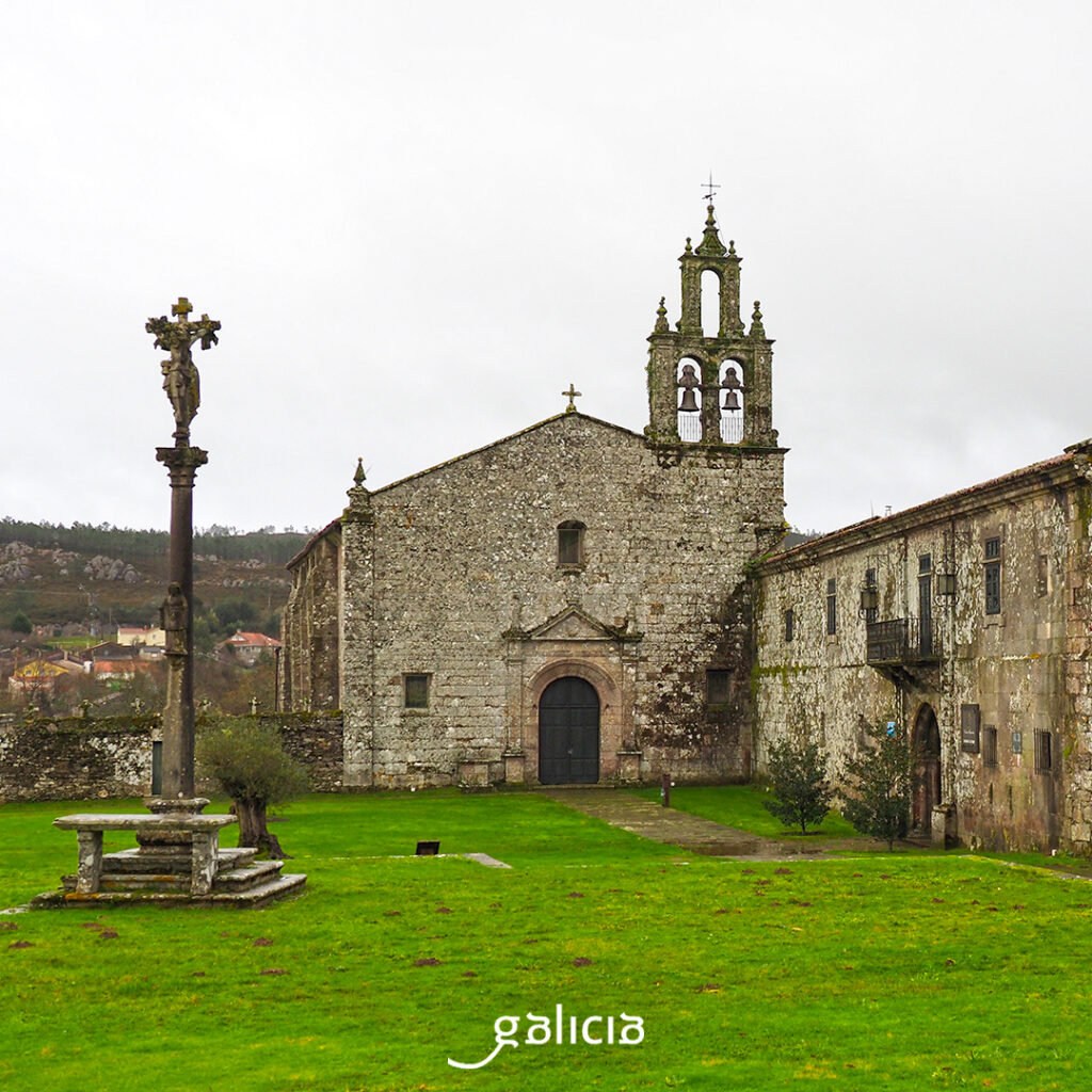
But, returning to the beginning, it must be said that the relief here corresponds to the southern part of the Galician Ridge, which is characterized by its staggering to the west. It is seen that the birthplace of the Lérez is good land, because very close the Benedictine order built an important monastery in the twelfth century, the Santa María de Aciveiro, today largely converted into a hotel.
In Forcarei we can accompany the river taking a walk along the Ruta das pontes do Lérez, a linear path of 28 km that passes through the municipalities of Forcarei and Cerdedo-Cotobade. In this distance there are no less than 20 bridges. Among them, the Romanesque Pedre, San Antón, Vella do Forno or Goimil.
The municipality of Cerdedo-Cotobade is crossed by the Lérez river, in a protected area with high environmental values and a variety of animal species, such as the otter, the bat, the dartford warbler or the red-backed shrike.
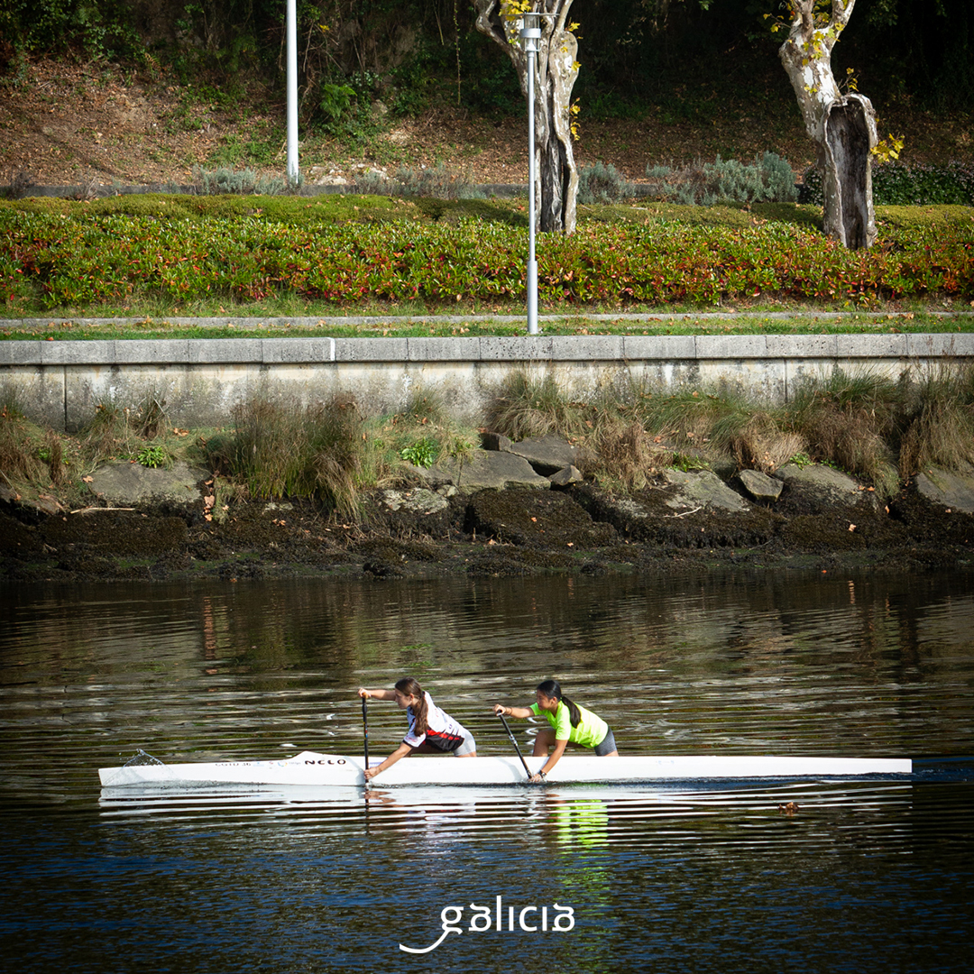
How about some trout and some mills? Well, we have some in the preserve that goes from Muíño do Penelo to the mouth of Regato de Quireza. In the area, there is also where to take a bath, for example, in the beach of Calvelo, which also has tables and stone benches for picnics.
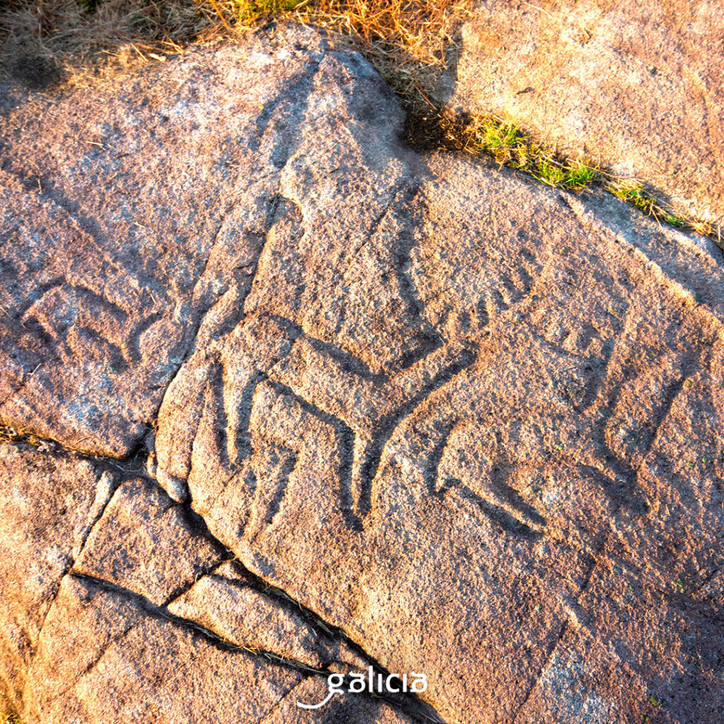
The Lérez is the southern limit of Campo Lameiro. In these mountains the castros and petroglyphs are very common. One of two examples of its archaeological heritage is the castro da Penalba, crowned by the Pedra da Serpe. From up here, we also have a fantastic panoramic view of the Terras do Lérez; or the Rotea de Mendo, at the foot of the castro, which shows a collection of rock engravings, among which a large deer stands out. There are hiking trails that help us to find them, such as the one from A Lagoa to Castro de Penalba, Paredes, Parada, San Isidro or Caneda.
Undoubtedly, there would be no better place to host a rock art park, or Campo Lameiro Art Park, which since 2011 increases our curiosity and knowledge about our most remote past. The park extends through the mountain, full of petroglyphs and the reconstruction of a Bronze Age settlement, and also has an interpretation center, with exhibitions and very interesting activities.
On the other hand, as for the natural heritage, we must talk about the recreational area of Lodeiro, with beach, at the junction of the Lérez with the tributary Muíños. Here there is a fishing preserve, mills, tables… Everything ready for a good river excursion.
Little by little we arrive at the mouth of the river, in the Pontevedra estuary. This is an open estuary, with the island of Tambo, in the municipality of Poio, near the coast and, already in the sea, the archipelago of Ons, in the municipality of Bueu, which is part of the Parque Nacional Marítimo Terrestre das Illas Atlánticas de Galicia. It acts almost as a barrier against the open sea.
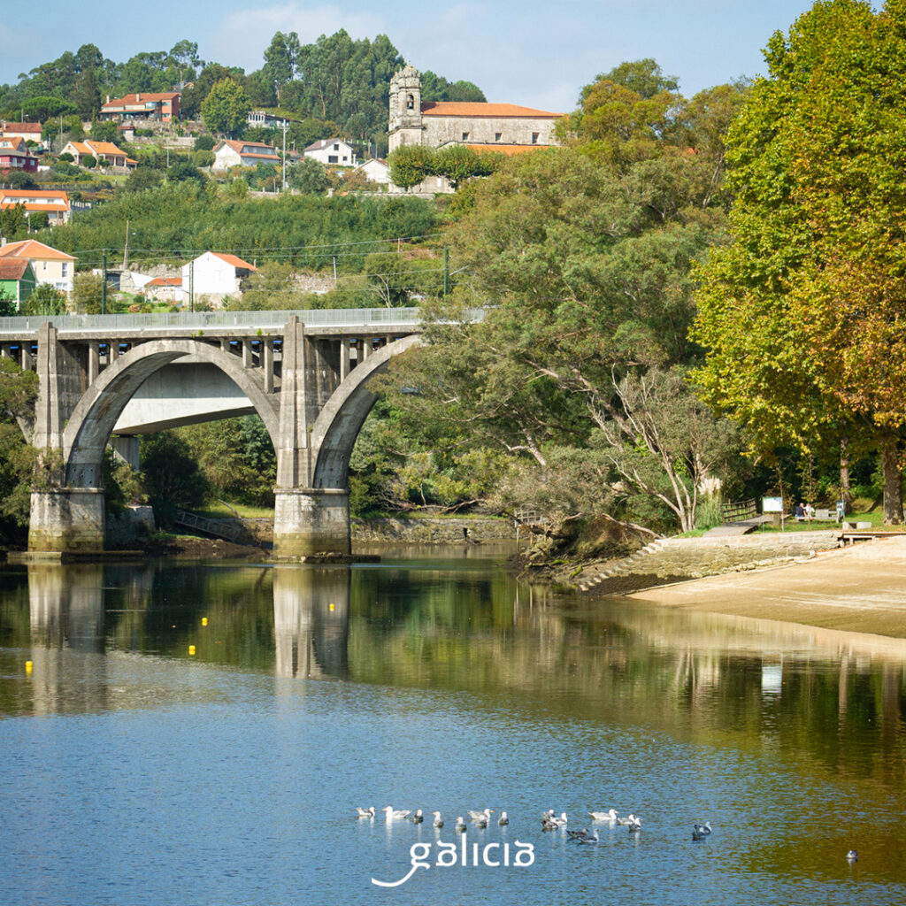
The coastline of the estuary goes from Punta Miranda, in O Salnés, to Punta Couso, in O Morrazo, an extension with very good seafood, very good beaches (A Lanzada, Montalvo, Silgar, Mogor, Aguete, Portomaior, Aldán, O Hío…), an important historical heritage (monastery of Poio; castros of A Lanzada, A Porteliña. …; historic center of Pontevedra…), unique villages, such as Combarro and its coastal hórreos, and large population centers, such as Marín, with its gigantic port and the Naval School, and Pontevedra, the capital of the province.
We go now to Pontevedra, where the Lérez river ends after crossing the city from east to west. Without leaving the city, along Buenos Aires Avenue, a bridge takes us to the Illa do Corvo. It is also known as the Illa das Esculturas (Sculpture Island) since 1999, when, as part of the actions of the Holy Year, a project was carried out to bring together a group of artists to integrate works made in the city. The result was an open-air museum of category, with works by Jenny Holzer, Giovanni Anselmo, Leiro, Richard Long…
If you want to complete the visit to this route along the river, you only have to follow the Lérez Paths. Follow this linear route for 6 km, which goes from the city to a small square in the parish of Bora. The path goes along both sides of the river, although the left side is more difficult. We have a river beach, a hanging footbridge, and the well-known “halls of the Lérez”, an ideal area for fishing, where the river is more abundant. Here are the remains of the spa of the village of Buenos Aires waters of the Lérez. After some rapids, we head to Bora, the end of the route.
Before the end, turning off a little on the right bank, we can visit the monastery of San Salvador, better known as San Benitiño do Lérez. There, on the day of San Bieito, July 11, it is the tradition of the pilgrims to smear their finger in blessed oil, previously burned in a copper pot, and pass it under the altar. Remedy for warts, mainly. And you know: “If you go to San Benitiño, don’t go to the one in Paredes, there is another more miraculous one, San Benitiño de Lérez.