The Umia is one of the most important rivers in the province of Pontevedra. It is not very long (70 km), but its course is very lively. It rises at a good altitude, about 700 m. In the upper stretch, it is joined by the waters of several streams in an elevated plain and, after gradually descending in height, it drops many meters all at once, in about 2 km, producing rapids and waterfalls. Already from Caldas de Reis, it calms down and flows quietly, watering O Val do Salnés, until it reaches the Arousa estuary, where we say goodbye to it among shellfish and marshes.
We find its source in the place of A Reigosa, in the parish of Aciveiro, municipality of Forcarei. We are in the southern half of the Dorsal Galega, which is falling towards the west, which is noticeable in the staggered terrain. The Umia and the Lérez begin their journey in these mountains. The Umia flows northwards and the Lérez towards the center and south.
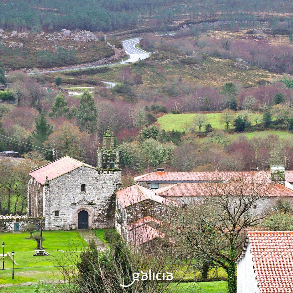
Forcarei belongs to the region of Tabeirós e Terra de Montes together with A Estrada and Cerdedo. Aciveiro, where in the past there must have been many holly trees, is a small parish but with a lot of interest, full of archaeological remains, cruceiros, hórreos (granaries)… The highlight of its artistic heritage is the monastery of Santa María de Aciveiro, founded by the Benedictine order in the 12th century and later reformed by the Cistercians. Today it is used as a hotel. In this work, as in other smaller ones in the surrounding area, such as the church and the cruceiro of Santo Martiño de Forcarei, the stone carving work is remarkable; in fact, this area has always been known for its stonemasons. The wax workers were also very famous. Things that we can verify approaching the Ethnographic Center of Terra de Montes, in Soutelo.
Between the municipalities of Forcarei, A Estrada and Silleda, south of Monte de San Sebastián, there is a protected natural area of great interest: the Lagoa Sacra de Olives and Brañas de Xestoso, more than 1,000 ha of mid-mountain wetlands, the best example of acid peat bogs in Galicia.
The Camiño da Geira e dos Arrieros and the Miñoto-Ribeiro pass through Forcarei. These two, as well as the Camiño Sanabrés, also cross A Estrada, capital of the region. In A Estrada the mountains of the Dorsal continue to the south and the valleys to the north. The Umia runs through the mountains and the Ulla through the flatter area, serving as a boundary with the province of A Coruña.
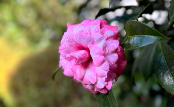
In this area there are many hillforts, such as Marcenlos and Trocastello, separated by the river (remember that the municipality borders with Campo Lameiro, a reserve of prehistory); Romanesque churches and manors, such as the baroque Pazo de Oca, our Galician Versalles, which in winter, until April, is more flowery than ever, with thousands of camellias, a must stop on the route of the camellia. The municipality is also known for being a powerhouse in furniture.
By the way, near Codeseda, there is a fishing preserve on the Umia, between the Loureiro dam and Ponte Paradola, where there are mainly trout. There is also a stretch for free fishing without death.
The relief of Caldas de Reis has nothing to do with that of Terra de Montes. Here, the Umia river flows through gentler terrain in its middle course, running through the municipality from north to south. The city is famous for its thermal waters, since Roman times (Aquae Celenae), and for the stay of Alfonso VII, son of Urraca and Raymond of Burgundy. The Portuguese Way and the Portuguese Coastal Way pass through here.
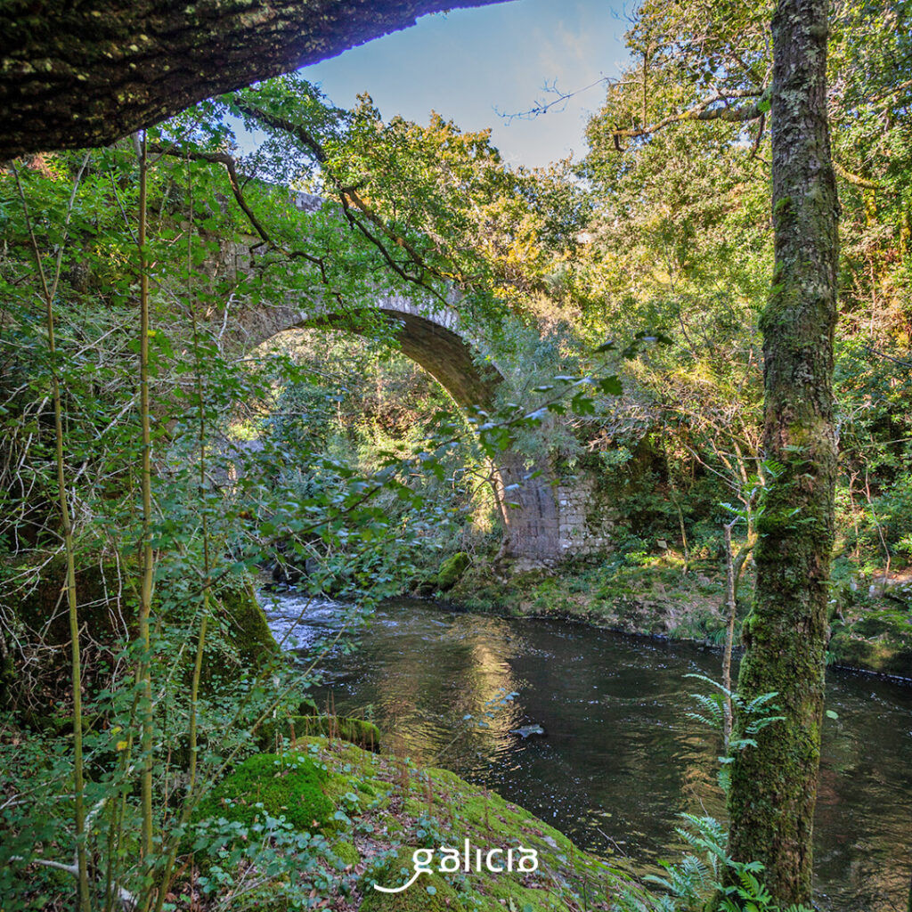
Just before reaching Caldas, the Umia descends from 100 to 40 m in 2 km. This slope causes a succession of rapids and pools. This is the origin of the Segade waterfall. There is a great route that goes from the Alameda de Caldas to the waterfall. Along the way we see mills, many of them restored, waterfalls, ruins of the light factory and the Segade bridge. From the waterfall, with a drop of about 30 m, to the Chorreras dam there is a trout fishing preserve.
In the center of O Val do Salnés, on the banks of the Umia, is Ribadumia, as the name says. The river crosses here from north to west, in its lower stretch, and has much to do with the richness of the land of the municipality, especially in the vineyards, which here give albariños and barrantes wines. We can see forts; Romanesque churches, such as Santo André de Barrantes; Baroque churches, such as Santa Baia de Ribadumia; pazos, such as Barrantes, O Monte or A Pedreira.
The Umia river route PR-G 173, a linear route that goes through Ribadumia, Cambados and Vilanova de Arousa, is very popular. It starts in Ponte Barrantes and arrives at Ponte Arnelas, which joins Ribadumia and Vilanova. This bridge is known for the fishing of the brown trout, mainly, and also for the fishing of the “godfather”. And it is also called Ponte dos Padriños (Godfathers Bridge), because women who wanted to have children came here looking for a “godfather”, a stranger who passed by the bridge to baptize them in the river. That was enough. Of course, if she had offspring, she would have to name them Alberto or Alberta, in honor of the saint of the bridge’s cruceiro.

Towards the last stretch, the Baixada Internacional do Umia is held, a canoeing event that is already in its 30th edition.
Cambados, the capital of Albariño, is the main center of the region of O Salnés. Here flows the Umia, which is the natural boundary with Ribadumia and, after descending through riverside vegetation and vineyards, creates a very rich estuary, where it feeds the natural shellfish bank of O Serrido. On this sheltered coast, mussels, clams, scallops and scallops are mainly found. There is a hiking route from the mountain of A Pastora, where we have good views of the estuary, which goes down by the ruins of Santa Mariña and the Ethnographic Museum do Viño, the cemetery and the path that goes along the river bank to the mouth, among reeds, where a very attractive ecosystem for birds from all over the world is formed.
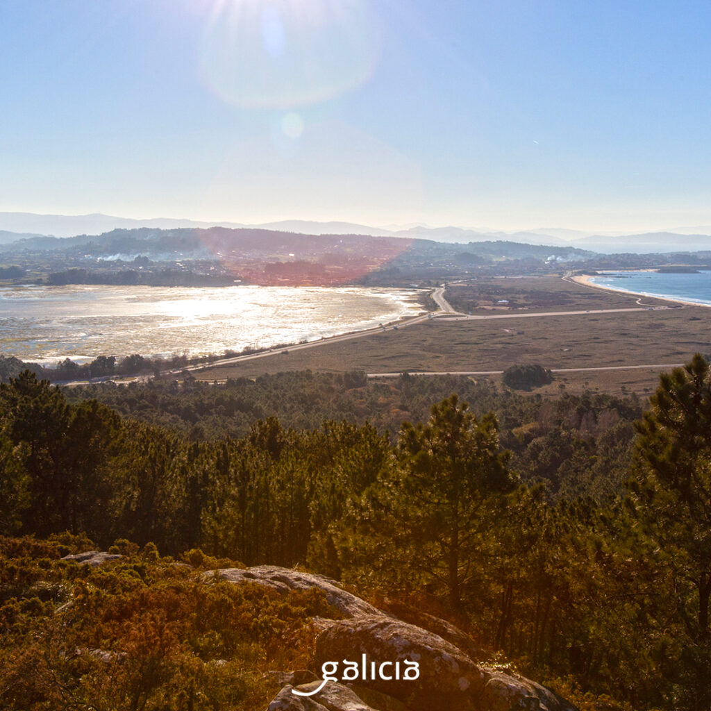
The Umia does not open directly to the ocean, but slides relaxedly towards islands and islets, to the north the Illa de Arousa, and to the south A Toxa and O Grove, an ancient island that eventually joined the mainland by the sandy sediments. In this isthmus, in the western part, we enjoy the beach of A Lanzada, with the island of Ons in front and, in the eastern part, the estuary, in front of the mouth. This is what we know as the Umia-O Grove Intertidal Complex, a triple protected area (CEE, RAMSAR and SCI). This is an exceptional area for bird watching, which has several observatories: in the cove of O Vao, the bay of A Lanzada, as Barreiras de Rouxique and the Umia estuary. One way to get to know the area is to do a section of the route of Padre Sarmiento: the circular stage of O Grove, which borders the peninsula, including the island of A Toxa, and the stage of O Grove-Cambados, following the coast.