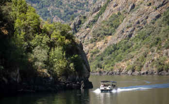

With so much coastline in Galicia, about 1,500 km, the variety of cliffs and beaches, shaped with personality by the Atlantic and the Cantabrian Sea, makes for a lot of walking. We show here some walks to let yourself be carried away by the views (be careful, do not end up in the water…). Three examples in the province of Pontevedra, in the province of Lugo and in the province of A Coruña.
Monte Boi Walk, Baiona. This mountain is on the Monte Boi or Monterreal peninsula, a perfect lookout in the Atlantic. Due to its strategic situation, over time it had many settlements. Nowadays, there are the remains of the Monterreal fortress, from between the 12th and 16th centuries. In the 20th century it was also renovated, and today it houses a national hostel. The promenade borders the perimeter of the fortress, so we face the Atlantic all the time, on one side the Nigrán coast, on the other the Cíes and, beyond, much more… America. The tour starts at A Cuncheira beach and ends at A Ribeira beach, or vice versa, of course. On the way, we can see the three watchtowers that are still standing: the Clock Tower, which was the one that gave the alarm signal in case of attack, the Tenaza Tower, which defended the port with batteries of shot, and the Prince Tower, which was originally a lighthouse. On the 2 km route, we also pass several beaches and even an ancient cetarean.
As Pedras Negras Trail, O Grove. The promenade leaves from the marina of San Vicente do Mar, and goes almost entirely along wooden walkways along the seashore, attached to the rocks. Following the edge of the map we pass the beaches of Pedras Negras, Farruco and A Barrosa, and some small coves. We have benches where you can rest and enjoy the views, with the Ons in front. The walk ends at Canelas beach, after 3.2 km.
From the Massó factory to Liméns beach, Cangas. Within the coastal path of Cangas-Donón, of a total of 23 km, we can do this smaller section, of 3.8 km. It starts at the old Massó factory. We advance to Lagoa de Congorza, with great biological wealth, especially waterfowl. We continue along the O Medio beach, the Areamilla beach, As Furnas, with a viewpoint and benches to rest, the Santa Marta sandbank and the great Liméns beach, the last stop, with its dunes and pine forests.
From A Rapadoira to Llas, Foz. Here you can breathe the Cantabrian from the front. This 2.5 km walk leaves from the port of Foz and goes along the cliffs to Llas beach. It also has benches and viewpoints, and even a wooden bridge over the sea, from which it almost seems that we are going to take flight like seagulls. Throughout the route there are points and coves: Punta do Cabo, Punta do Corno, Cala de Ronqueira…
Walk through Punta Socastro, O Vicedo. The route starts in the car park, 1.9 km before reaching the point. It begins as a track between pines and eucalyptus, and immediately we glimpse the end, in the famous Fuciño do Porco, in front of the Viveiro estuary. Until there some wooden footbridges take us that give a thousand turns, with many stairs. Not forget: in high season you have to make an appointment to walk around here, otherwise it gets crowded.
From Punta Morán to Sucastro beach, Xove. Small islands abound in this area of the Cantabrian Sea. Here we have the Farallóns islets to the east and As Salseiras to the west and the Ansarón islet, with many cormorants and seagulls. The cliffs of Morán are also known as Os Cantís de Papel (The Paper Cliffs), due to the shapes that the sea made on them, which left them like crumpled paper. In 2 km we stand on the Sucastro beach. We want more? Well come on, in 5 km more we are at A Punta Roncadeira and Mount Castelo, with its banks of Nacente and Ponente.
From Santa Cruz to Santa Cristina, Oleiros. We start at the port of Santa Cruz where, by the way, we can also cross to the island of Santa Cruz and take a walk around its perimeter. Returning to the port, then, we continue the walk until some stairs, which take us to the As Galeras Park. Here there is an expanse of fields and trees to spend the whole day, with panoramic views of the Santa Cruz cove to Mera and A Coruña. From there we went down to the Bastiagueiro beach and then went up to the viewpoint of the Nirvana park. Leaving the park, go down one street towards Paseo de Santa Cristina, where the route ends, if we want. In total, 4.38 km.
From the Area Maior beach to Santo Hadrián, Malpica de Bergantiños. The path begins at the Malpica promenade. After skirting the Area Maior beach, we ascend little by little until we have a good panoramic view of the complex. From here, we go to the beach of A Seaia. And go up again, to the Navenllos fountain. And, still higher up, we come to the hermitage of Santo Hadrián, from the 16th-17th centuries, (renovated in 20th century), and to the fountain of the saint, which it is said that is a miracle worker. As we can see, we start from the seashore and then distance ourselves, along 3.6 km. If we dare, from here we can continue the Camino de los Faros, which ends in Fisterra, in short, it would already be 200 km…
From the beach of Mar de Lira to Portocubelo, Carnota. This is a short walk, 1.13 km, but intense. The views are diverse: we have Mount Pindo in front of us; to the northwest, the Corcubión estuary and the Lobeiras islands; beyond, Fisterra and, just ahead, fantastic views of Carnota beach. The path runs along a wooden platform and ends at the Portocubelo pier, a fishing village with a lot of flavor. We can also follow the route to the Lariño lighthouse, if we want to have another perspective of the landscape.